
Heading into Utah for a park fest, which doesn’t involve music, we knew our O Level Geography and Geology wasn’t going to cut it in understanding the landscape around us. We did our best! We did however, have a magical experience and came away with an appreciation of the differences between each of the places. (National Parks, State Parks etc) Someone had said to us, when you’ve seen one lot of red rocks, you’ve seen ’em all, certainly not the case for us. The shaping of the landscape over millions of years through tectonic plate shifting and erosion (simplifying!), different sedimentary deposits laid down through all the different periods over millennia, creates an array of colours and a variety of geological forms. Utah has such an impressive landscape, it’s hard to describe but here’s our favourite places, after 23 days looking at red rock! Hope it’s not too dull! We were headed into some epic landscapes to make us ‘sic’ apparently 🙂

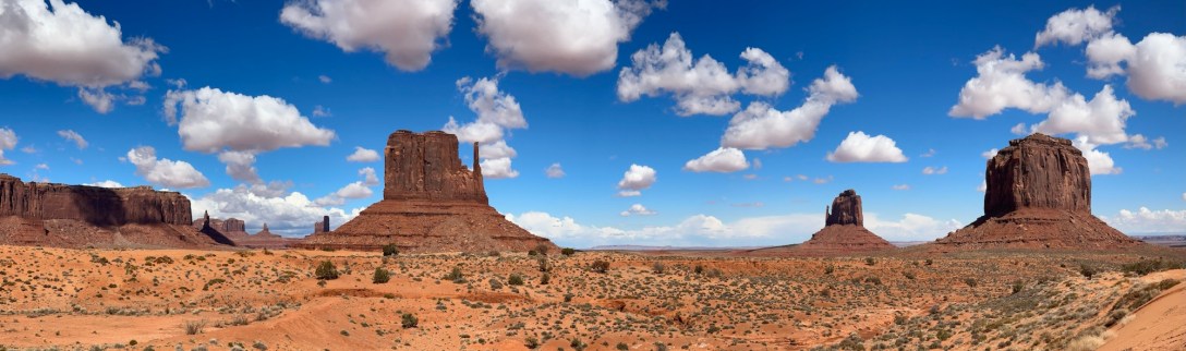
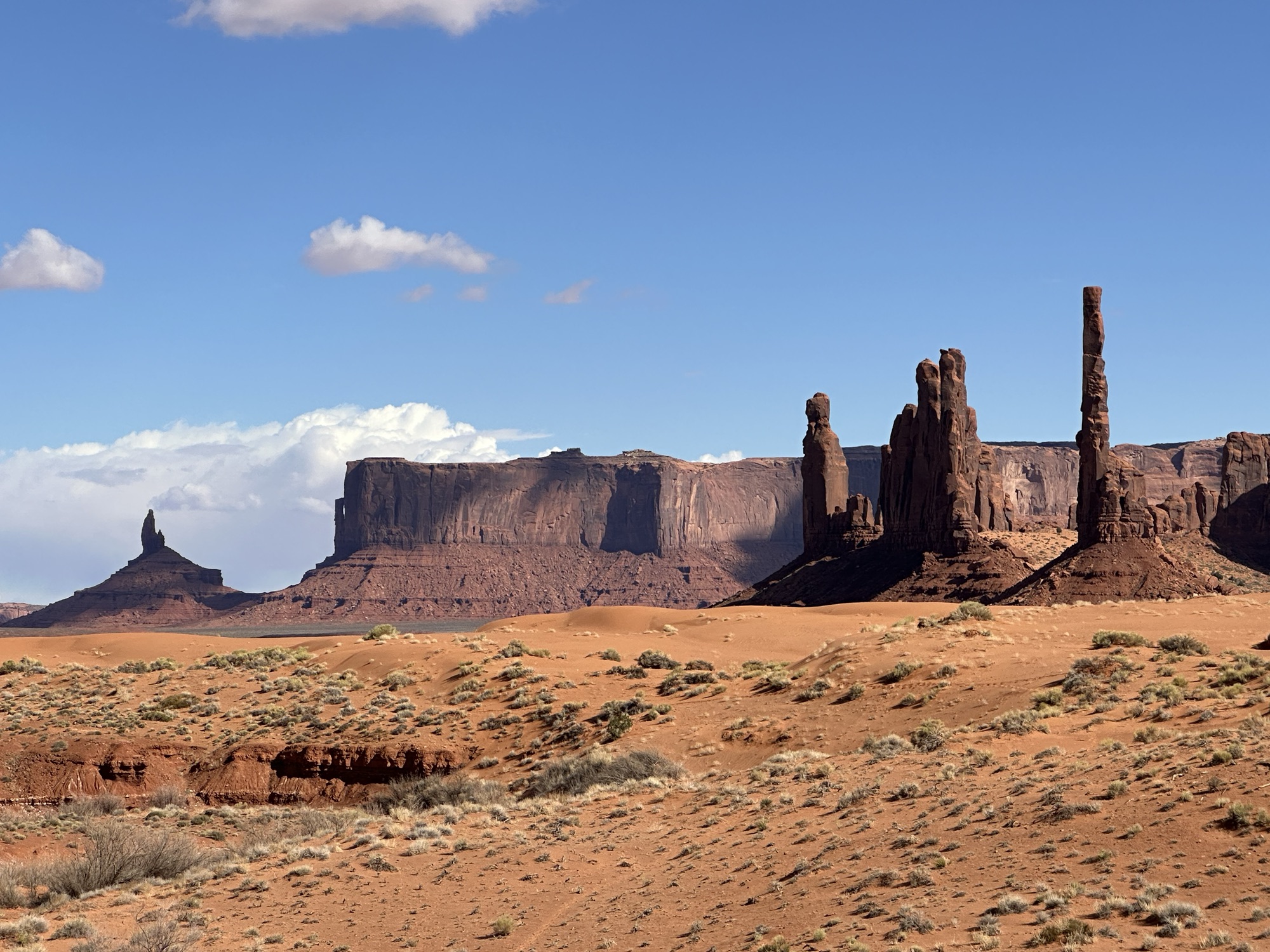
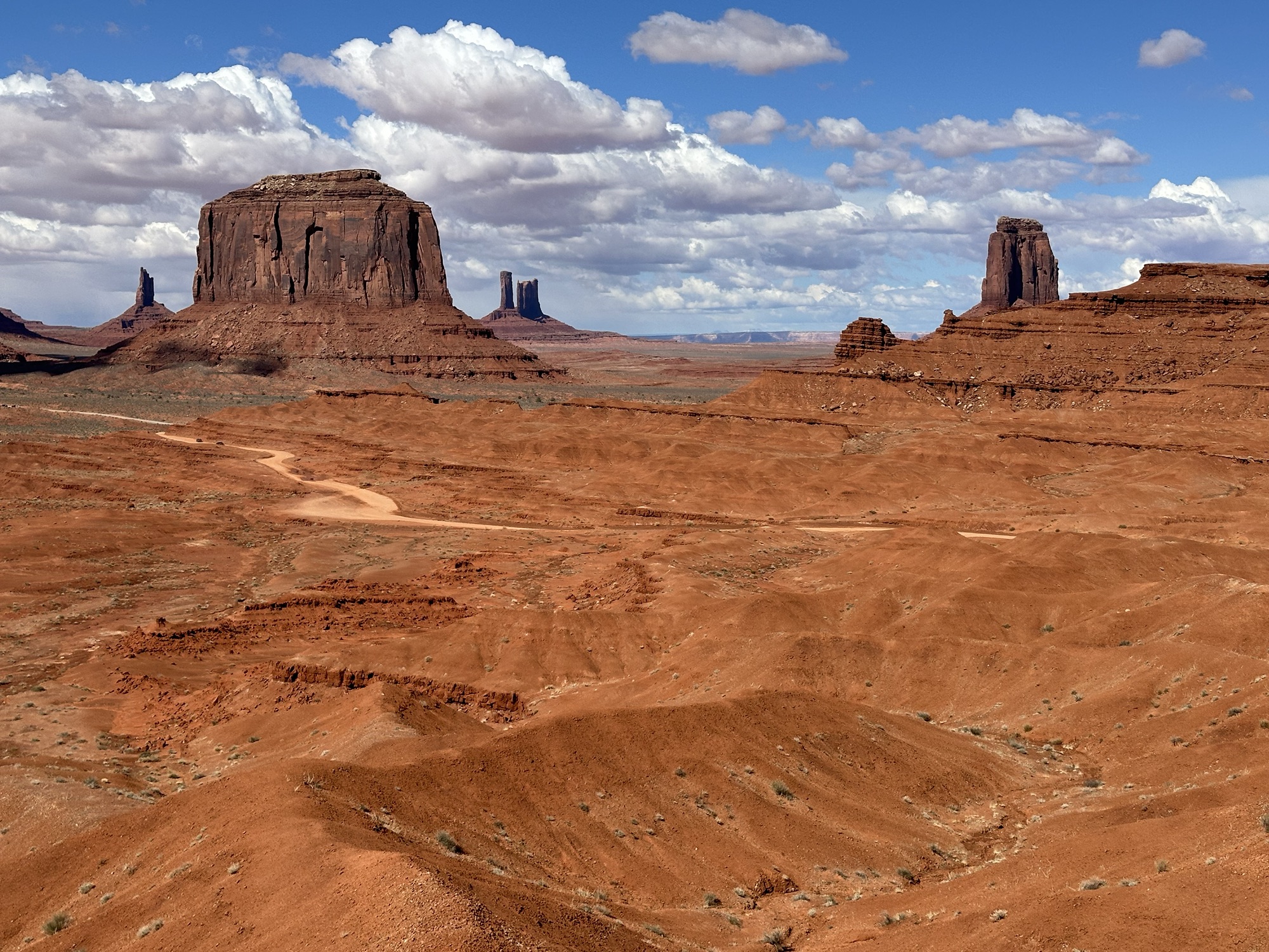
Monument Valley is one of many big ticket destinations around, it’s on the border of Arizona and Utah and to get to see it we had to rent a Jeep for a half day. The local Navajo are canny business people! Initially high up, the views were of huge monoliths of rock, called Buttes over here. Looming out of the flat valley floors these days, it’s hard to imagine that the valley floor is the result of erosion, leaving the buttes. As always, we see all kinds of things in the rocks, including cloaked figures surveying the lands. The shapes and forms were stunning as the light changed too. The visible sedimentary layers and eroded smooth or rippled surfaces, the curvaceous lines of the deposits and the sheer, sharp edges where rock had peeled away as though cut with a butter knife, were a spectacle we thought would be hard to beat, we were wrong!


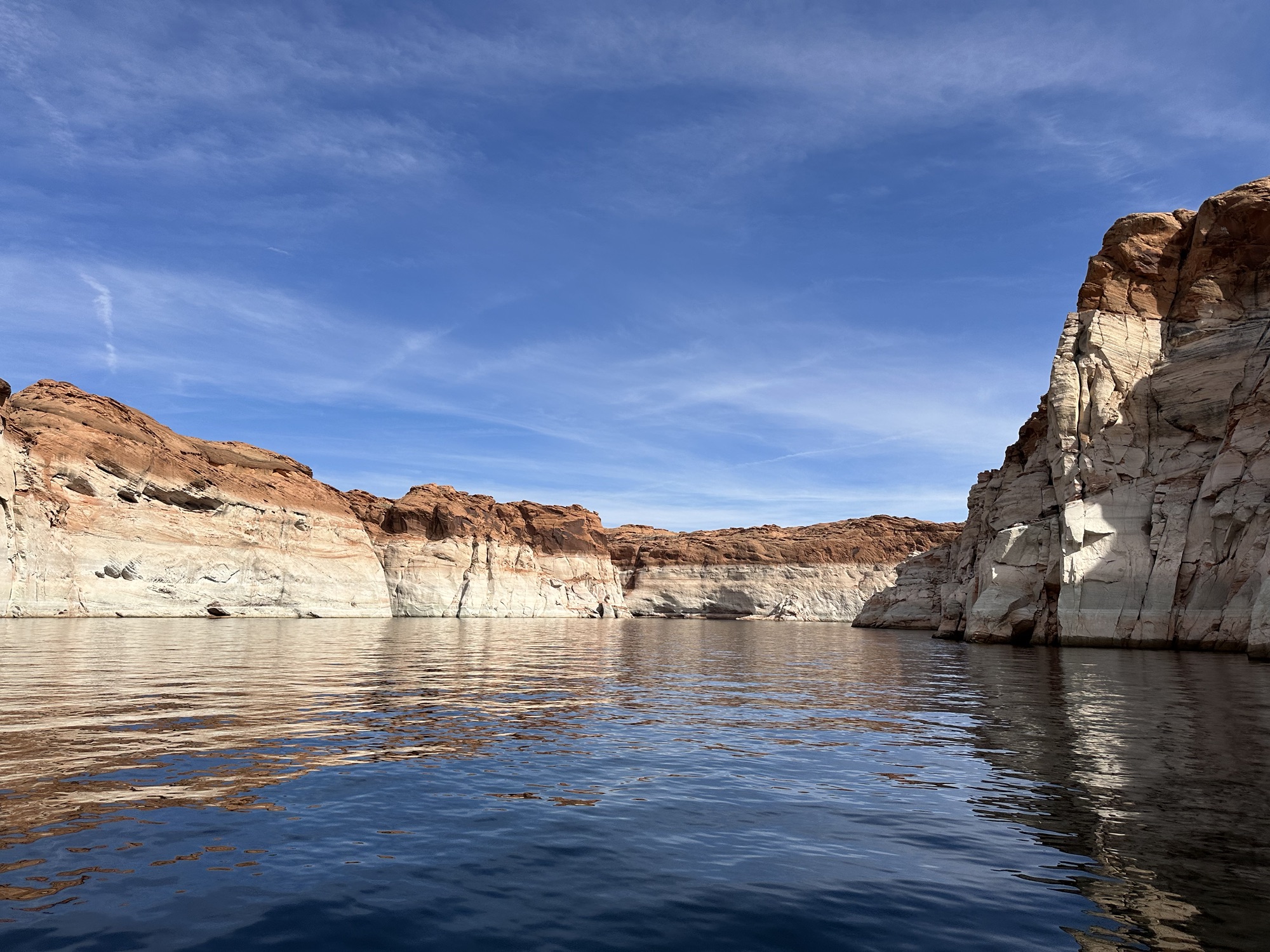
A second visit through Page, still Arizona, home of the amazing slot canyons we visited in October last year, we noted that the Glen Canyon Dam appeared even lower than before, c. 2m apparently, if the water fill is close to 20% (was 32% full then) they’d be shutting down the hydro electric, can you imagine the consequences… We’d hiked up to Hanging Gardens which gave us a fascinating perspective. Chatting always gets in the way of exploring, a Dutch couple this time, so we adjusted our plans and took a boat tour up The Powell River to see the canyons from a different perspective. The first being that of hundreds of ‘recreational house boats’ moored at the marina. It was a wonderful experience, the white stripe marking confirmed the water level of only a year ago. The last time it was full was 1999. The visible vertical stress fractures in the rock and tectonic movement was really evident, especially where rock had sheered off into the water at these weak points.


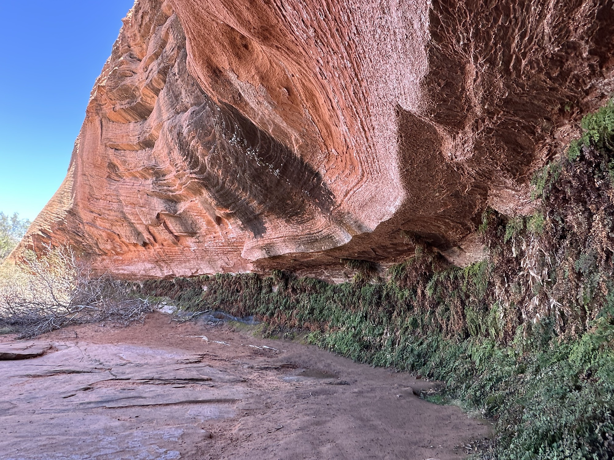
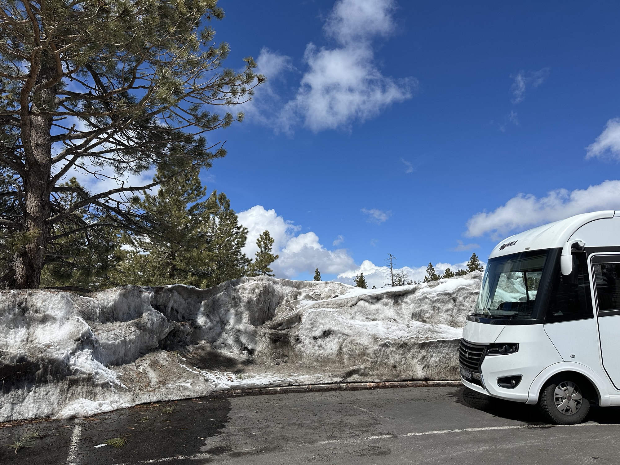
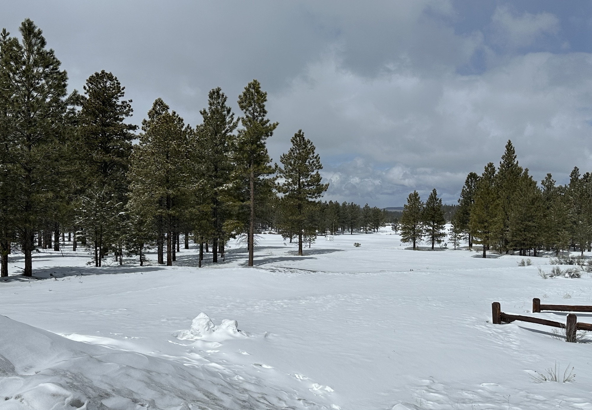
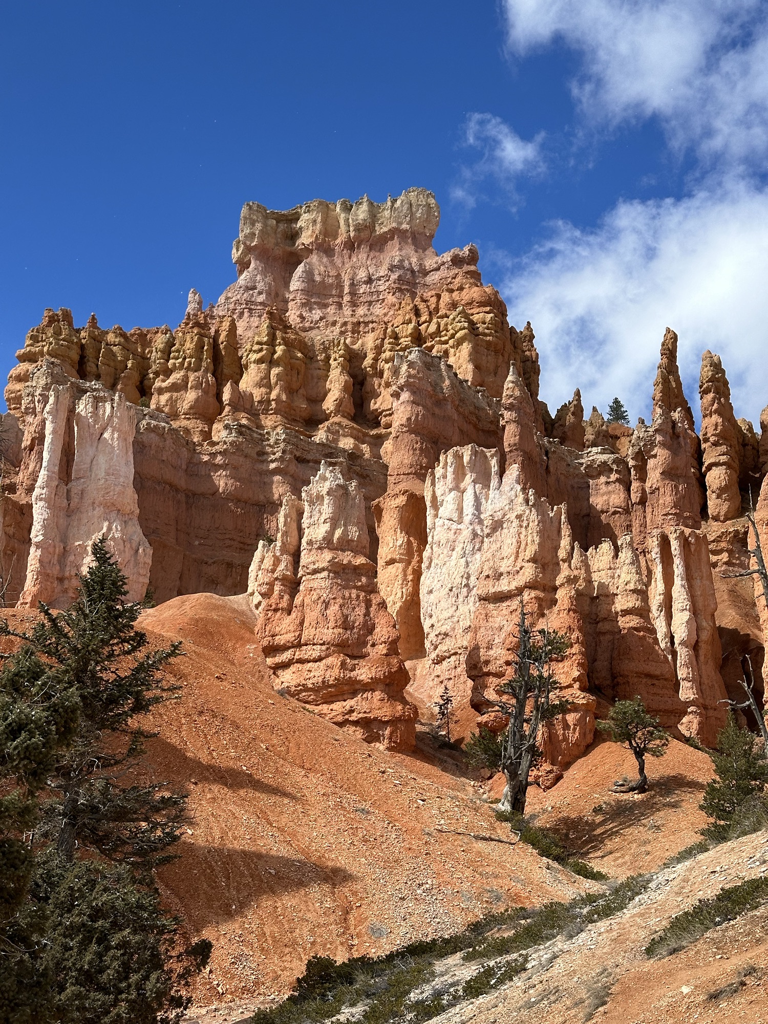
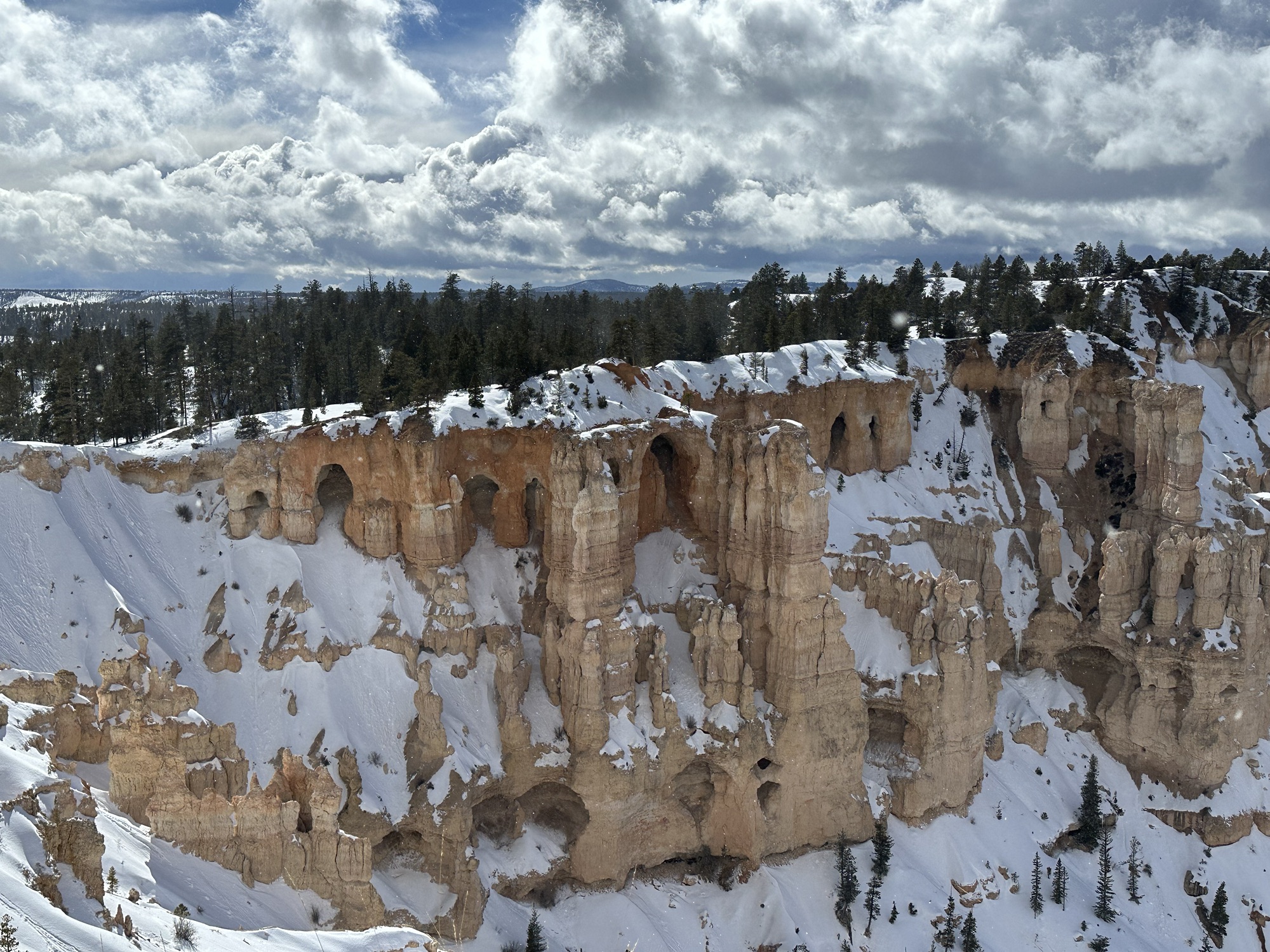
After a night at one of our all time fave campsites (Dark Skies RV near Kanab) we headed towards one of Utah’s ‘Big Five’, Bryce Canyon National Park, our 2nd of the 5 after Zion last year. Obviously different to Africa’s Big Five! En route, we stopped for a hike at ‘Belly of the Dragon’ trail which had a fabulous tunnel at the trail head with stripy rock walls. Continuing an up, up, and away drive to Bryce at over 8k feet, the landscape became alpine and snowy. A hike on Mossy Cave Trail, we could see what we’d come to admire the following day, freestanding spires of rock, challenging gravity, like driving through a series of red rock shards. We could see some arches, which in time collapse in the centre, to create the towers.

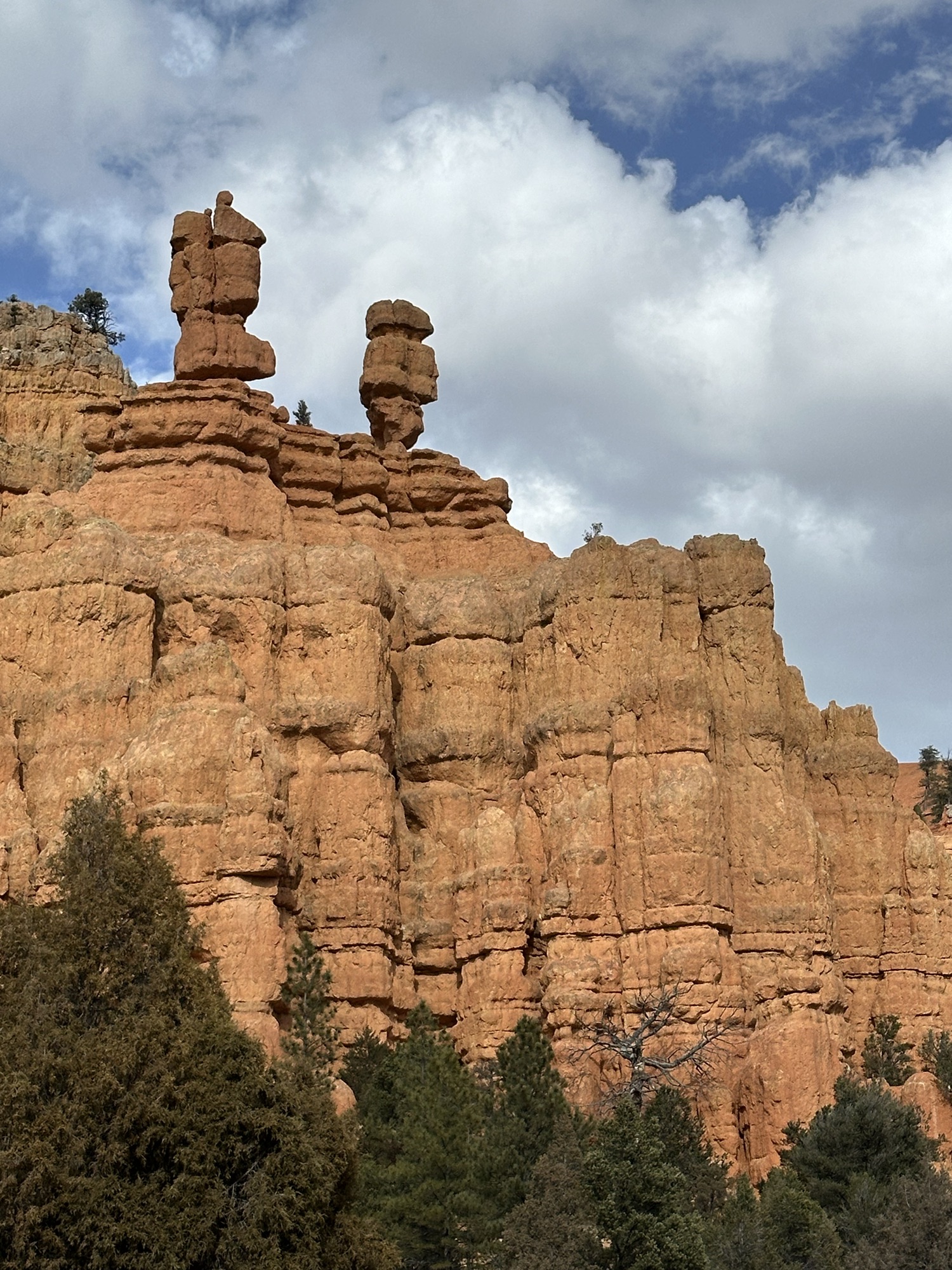
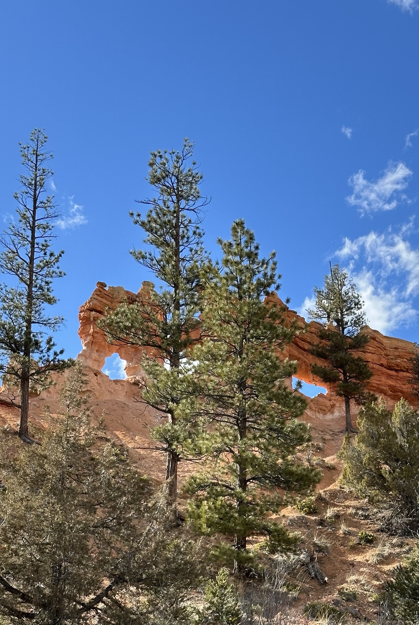
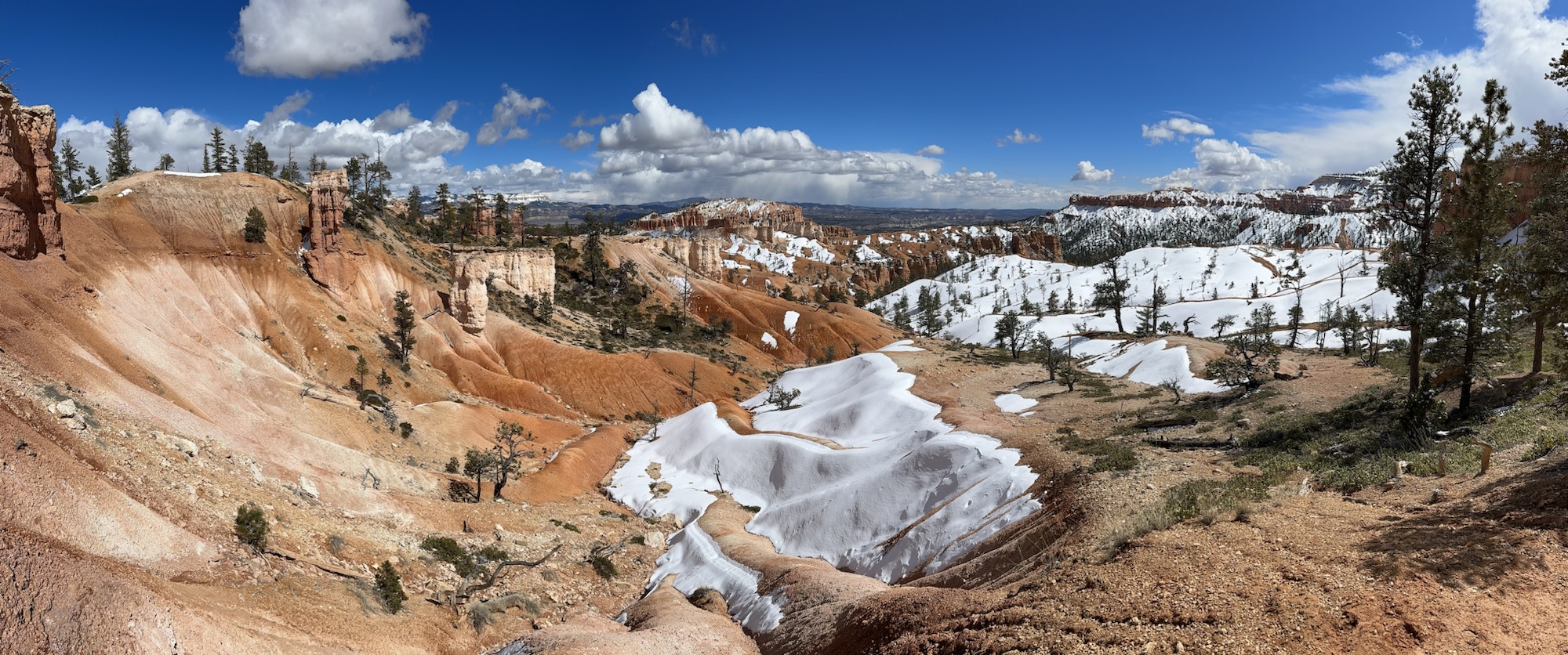
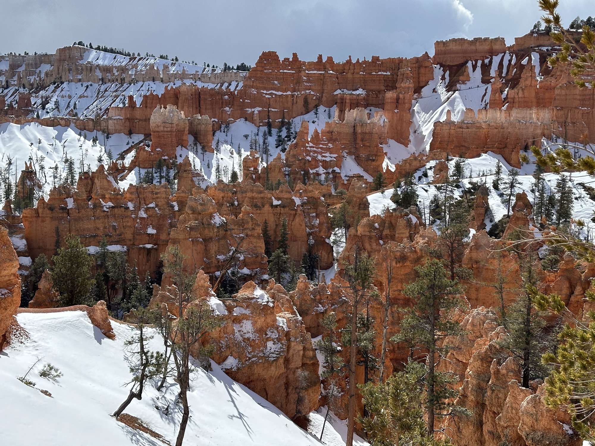
Bryce Canyon National Park was as mind blowing as the wind, t’was blowing a hoolie and it was bloomin’ cold! The eras of rock formations, 12 in total, laid down from 525 million years ago were uplifted between 70 and 45 million years ago and started to erode on exposed edges exposing the pink and red colours seen at Bryce, the alternating layers of different rocks eroding differently in the winds and rains. The spectacular amphitheatres created, with the densely packed in, standing towers or shards of rock contrasting against the white snow was a spectacle. There were balancing rocks on spindles and a series of natural arches, waiting to become towers themselves. Numerous hikes and viewpoints gave a commanding view of the Canyon and its indescribable beauty, with a spectrum of colour Dulux would be proud of. Could it get any better? Maybe, or perhaps different again?


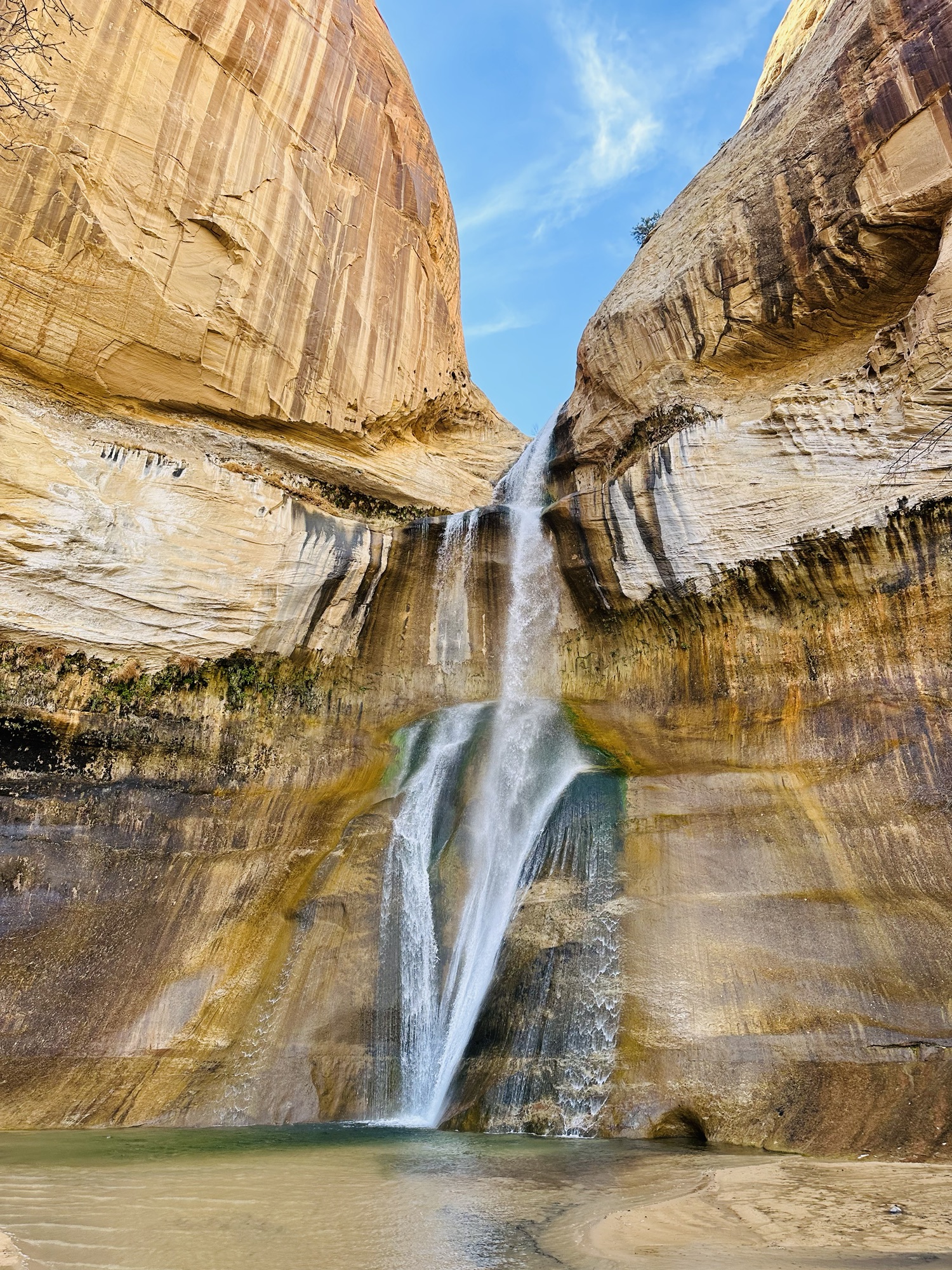
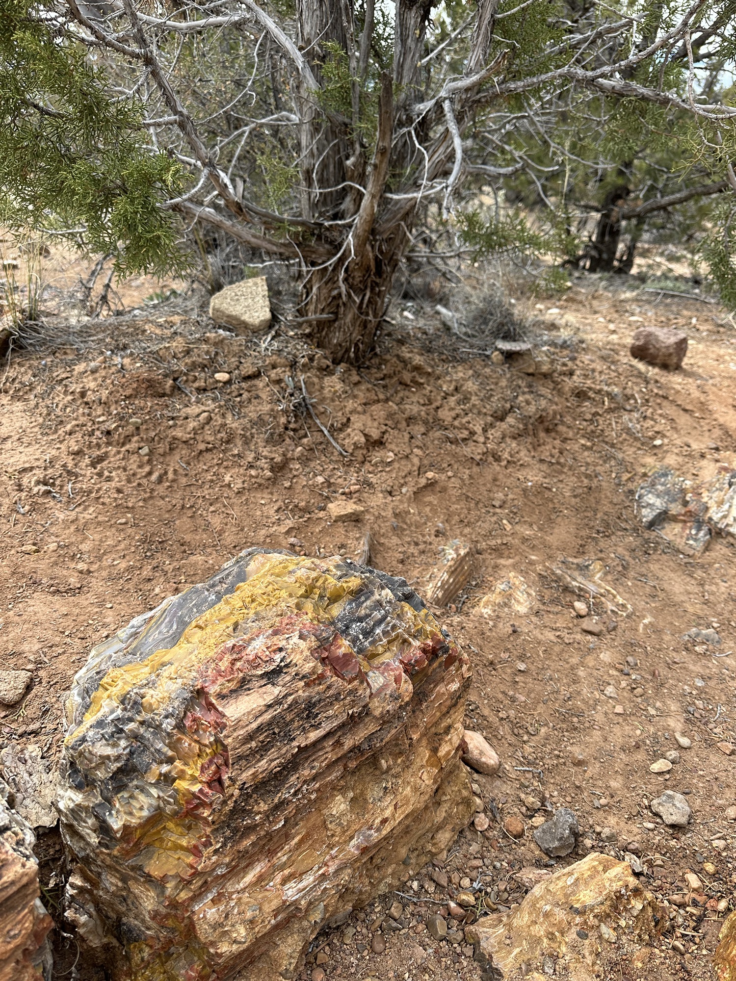
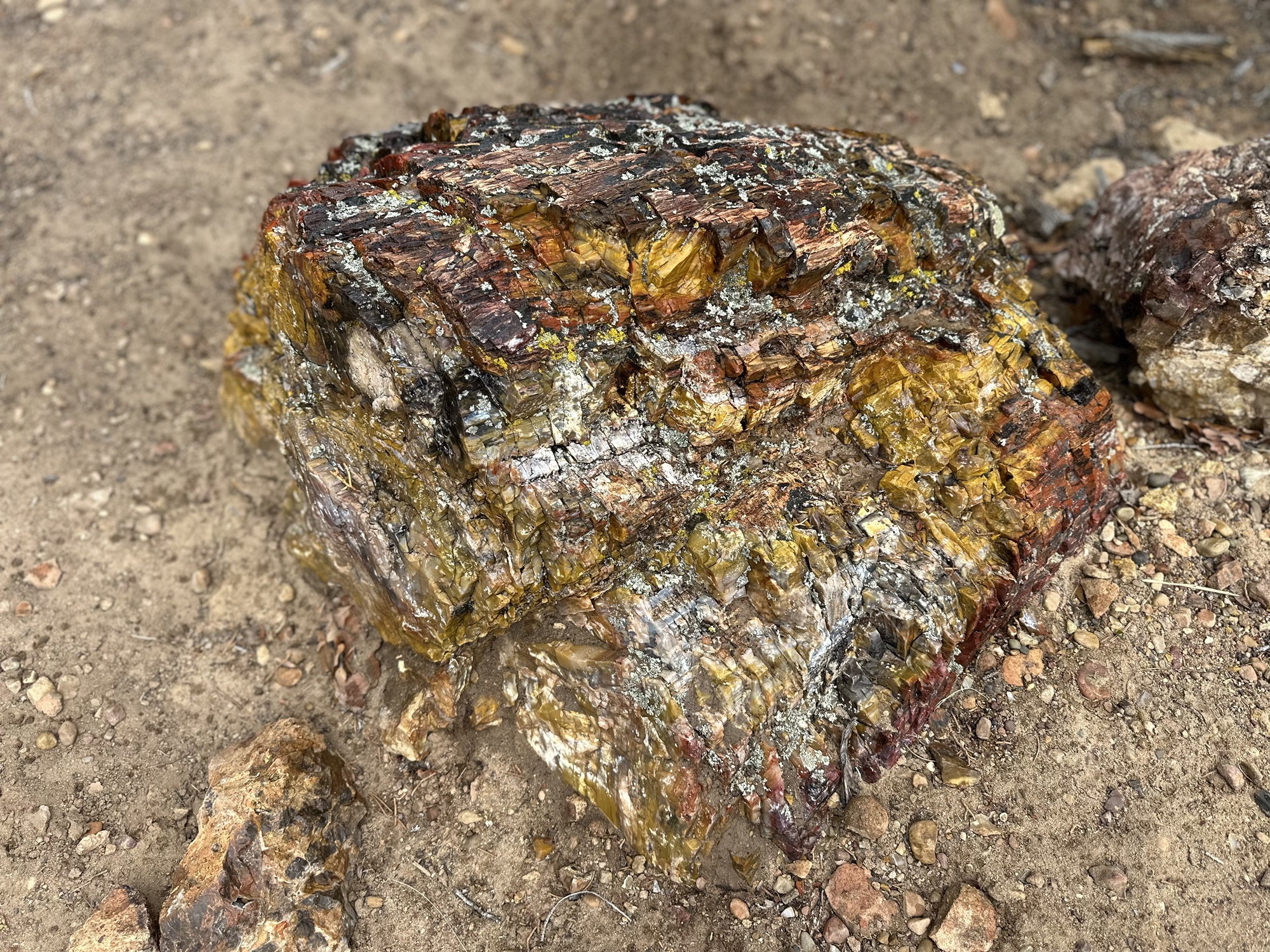
Kodachrome Basin State Park, in terms of visitors, the opposite to Bryce. Less intense an experience it’s known for its ‘sand tubes’ that aren’t really tubes. It is sediment pushed up through weak vertical rock fissures to the surface, eroding internally as it flows and solidifying, leaving strange columns of rock as the land around subsequently erodes. A fabulous hike and great views. From there we headed to Escalante Petrified Forest State Park, not one to be scared of though! An amazing hike took us into an area called ‘Sleeping Rainbows’ chock a block with petrified wood and fabulous colours. The photographer of the two of us was splashing water everywhere which made the colours pop like a bag of M&M’s… Another fave here was Lower Calf Creek Falls, a 6.5mile hike along a valley to a waterfall. It shows off the unique features in Grand Staircase Escalante National Monument, beaver ponds, immense, sheer faces of rock, desert varnish (the dark stripes on the surfaces) and plants and trees waking up along the valley floor.


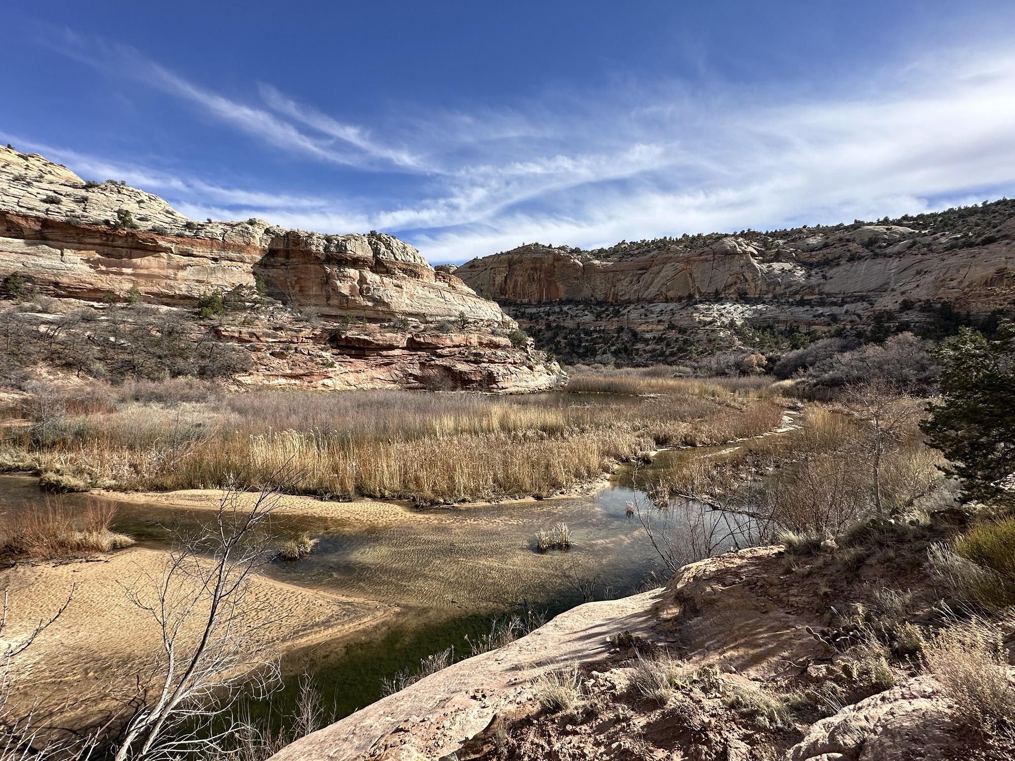
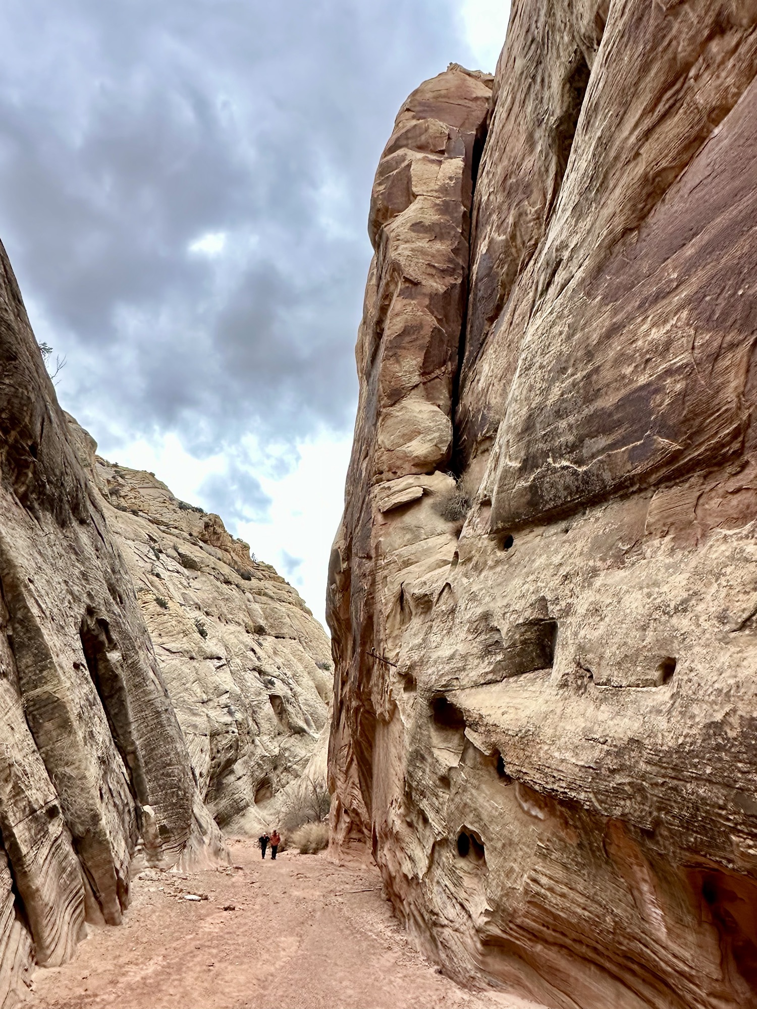
We broke our altitude record, heading over Boulder Pass in the snow with the stunning white Aspen’s and the long views of the sunlit mountains. We arrived at Capitol Reef National Park (Utah no. 3) It was a serene stay, in the Fruita Historic District, know for guess what, it’s history of fruit farming…. and still going strong, fruit pies. Yes, they were sampled, once or twice! The areas origins are from 1880’s and Latter Day Saints pioneers, where a maximum of 10 families resourcefully managed the terrain. Mormon pioneers built waterways for orchard irrigation etc. On our way there we stopped at ‘Goosenecks’ which provides an epic view of Sulphur Creek, the bottom being 800ft below. A tributary of the Colorado, its meandering curves were stunning. An amazing fact to us was that the bottom of that canyon is the top of the Grand Canyon, further south. Capitol Reef as a park shows off the power of water erosion with towering cliffs either side of a narrow dry streambed. The rocks were like swiss cheese at times, created by eddies a long time ago and the desert varnish darkened the scene from the red rock beneath.


Being fans of the alternative, Carls Critter Garden was a must see. In Hanksville, Utah, home of Mr. Williams, it is a delightful and quirky roadside attraction. Another art paradise, testimony to the creatives of this world, it’s all recycled machinery and scrap with two key themes, dinosaurs and ‘Peace & Love’. Across the road was an old petrol station, recycled into a funky coffee shop!


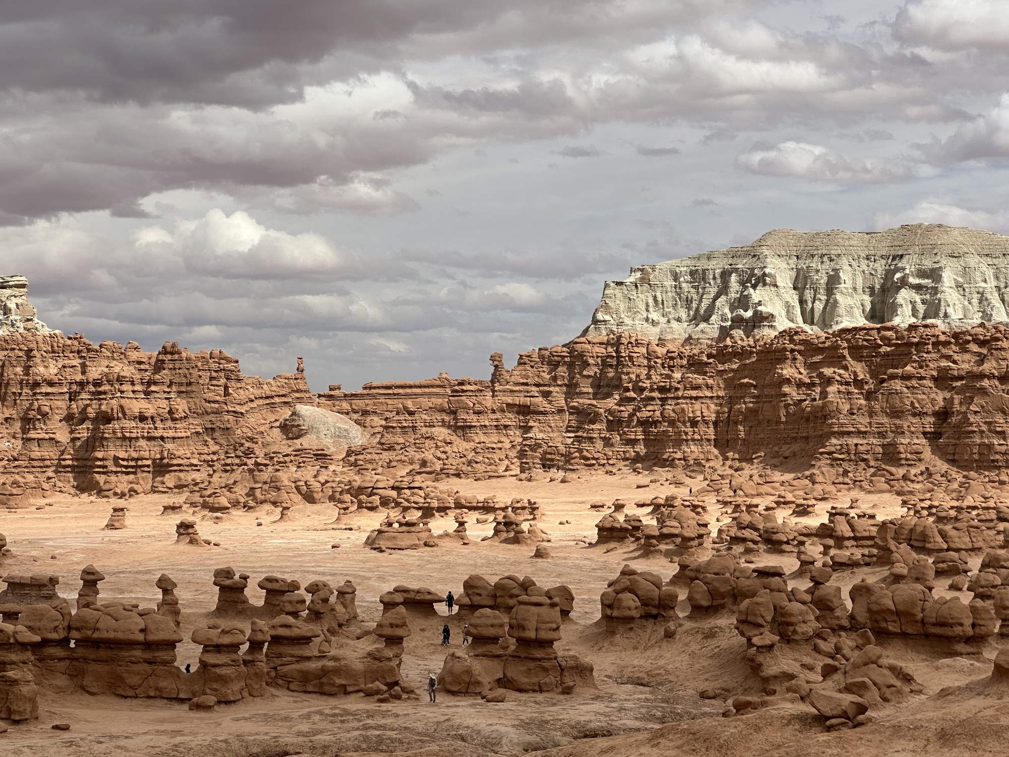
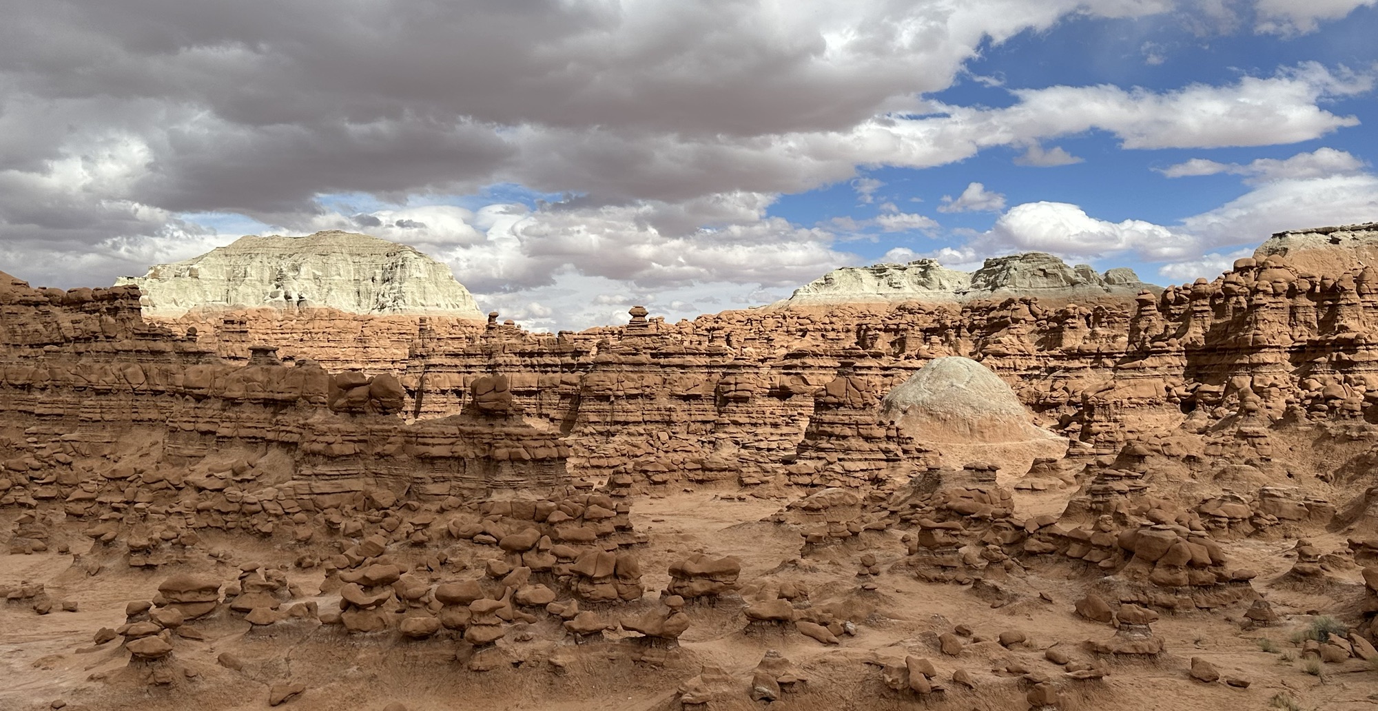
Goblin Valley was as quirky and different as the name suggests. Driving across a badlands area which became an agricultural and wide valley floor, the landscape was smooth sided and scree sloped for a change. Then some low hilly areas and some dense clusters of cottonwoods evidenced water and the ATV/OHV tracks evidenced well, who am I to say…There were plenty of RV’s with their toy haulers corralled around the place. Big Wild Horse Mesa Wilderness showed off mesas like small rock islands in a desert sea before we arrived to a spectacle that children’s books are imagineered from. Out of this world, a sandstone environment packed with ‘stone gnomes’ or goblins. Technically hoodoo’s they are spheroidal and stunted versions as the Entrada sandstone erodes quickly. A wonderful walk among them, thinking of ideas for a book, magical and unique. So many goblins, so little time 😉


End of Utah, part 1…. I decided enough was enough for now!! I feel the tumbleweed rolling across your eyes, like we saw roadside. I promise though that there is some even better stuff to come as we close our Utah loop. 🙂


You two have been to some stunning location, this post is going to take a lot of beating. Fab u lous…
LikeLike
WOW❤️. Maggie
LikeLike